Mae Tha Fm
Type Locality and Naming
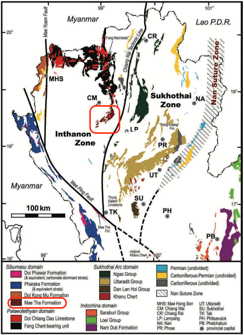
NW Thailand, north of Mae Ping Fault. Type area: along the Chiang Mai – Lampang Highway (Route 11) near Mae Tha, west of the Mae Tha River in Lamphun Province.
Synonym: กลุ่มหินแม่ทา ; Mae Tha Gr
[Figure: Distribution of Carboniferous and Permian strata in Northern Thailand. Data mainly based on 1:1 million scale geological map of Thailand (DMR 1999) with minor modifications (Ueno K. & Charoentitirat T., 2011, page 75.)]
Lithology and Thickness
Quartzite, siliceous shale, quartzitic sandstone, feldspathic sandstone, kaolinitic shale; andesite, rhyolite, tuff, breccias, pyroclastic chert and green shale, agglomerate, conglomerate, sandstone, slate and light grey to pinkish-grey, massive to well bedded, re-crystallized limestone. The Mae Tha Formation in the type area is strongly folded and faulted, and its exact stratigraphic relations are difficult to establish.
Relationships and Distribution
Lower contact
Upper contact
Possibly the next younger unit is a Middle Permian limestone; although "neither a detailed stratigraphic succession from the Mae Tha Formation up to this limestone nor concrete biochronological information on this limestone have yet been documented." (Ueno & Charoentitrat, 2011).
Regional extent
Northern Region: Chiang Mai and Lamphun provinces.
GeoJSON
Fossils
Age
Depositional setting
Shallow shelf. "The formation is considered to have been deposited in a shallow-marine (probably paralic) environment based on its lithology, although detailed strati- graphical and paleontological investigations are required." (Ueno & Charoentitrat, 2011)
Additional Information
